


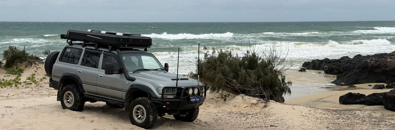
K’gari Tides and Beach Driving: When to Drive 75 Mile Beach and How to Plan Your Day
TL;DR: The best time to drive K’gari’s eastern beach is the two hours either side of low tide. Queensland Parks advises avoiding beach driving during the two hours either side of high tide. The eastern beach has an 80 km/h maximum speed limit, dropping to 40 km/h in beach pedestrian areas, while inland roads are generally 30 km/h and shared-use areas are 10 km/h. You’ll also need to give way to aircraft using the beach. Tours plan their stops around the tides, which is why the same trip can run in a different order from one day to the next.
You roll off the barge, lower your tyre pressure, wind the window down and turn onto the eastern beach with the ocean on one side and sand dunes on the other. It is one of those Australian drives that feels a little ridiculous in the best possible way.
Get the tide wrong, though, and that same beach can mean soft sand, wash-outs, deeper creek crossings and a very long arvo.
That’s why K’gari trips are planned around the tides. Don’t worry, it is easier than it sounds. Here is when to drive, what the rules are and how to plan your day around the water.
Why Does the Tide Matter on K’gari?
The eastern beach is a designated road, so Queensland road rules apply even though you are driving on sand. It is also the main route to many of K’gari’s best-known coastal stops, including Eli Creek, the Maheno shipwreck and the Pinnacles.
The catch is that the beach changes throughout the day.
Around low tide, there is usually a wider stretch of firmer sand to drive on. As the water comes in, that space gets narrower and waves can wash further up the beach. Strong onshore winds and swell can make conditions more difficult, even when the tide itself looks manageable.
Creek crossings can change too. Wash-outs and deeper water can appear at places such as Eli, Wyuna, Awinya and Coongul creeks, so do not assume a crossing will look the same every day.
If the tide is pushing you towards the dunes, wait rather than trying to drive around the water. Driving on the dunes and foredunes is prohibited, and soft sand can also make a vehicle unstable.
When Can You Drive on 75 Mile Beach?
Queensland Parks keeps the advice fairly simple: the best beach-driving times are two hours either side of low tide, and you should avoid driving during the two hours either side of high tide.
Here is what that means in practice:
| Time relative to low tide | What to expect |
| More than 2 hours before low tide | Conditions may still be improving, so check the beach and weather before setting off. |
| 2 hours before to 2 hours after low tide | This is generally the best window for beach driving. |
| More than 2 hours after low tide | The usable beach can become narrower as the tide rises. |
| 2 hours before to 2 hours after high tide | Queensland Parks advises avoiding beach driving during this period. |
The tide is not the only thing that matters. Wind, swell, recent weather, wash-outs and the condition of the beach can all affect how easy it is to drive.
For example, a strong onshore wind can push water further up the beach, leaving less firm sand to work with. If the waves are already reaching the soft sand, it is better to wait than to push your luck.
Your afternoon will be much more enjoyable if it does not involve digging a 4WD out of the beach.
What Are the Beach Driving Rules?
Beach driving on K’gari still counts as road driving, so Queensland road rules apply. There are also some specific rules for the island that are worth knowing before you arrive.
- The maximum speed on the eastern beach is 80 km/h, although you may need to drive more slowly when conditions require it.
- The speed limit is 40 km/h in beach pedestrian areas.
- The speed limit on inland roads is generally 30 km/h.
- The Hook Point inland road has a 50 km/h speed limit.
- The speed limit in shared-use areas is 10 km/h.
- You must give way to aircraft using designated landing areas on the beach. These areas are marked with orange cones.
- Everyone in the vehicle must wear a seatbelt.
- You must not drive on the dunes or foredunes to avoid the tide.
- If you need to cross a creek, assess the crossing first and never stop in the middle of it.
- Keep luggage and other heavy items packed low inside the vehicle. A top-heavy load can increase the risk of a rollover.
- If you lower your tyre pressure for sand driving, stay within the vehicle manufacturer’s recommendations and remember that lower pressure affects braking and handling.
You will also need a vehicle access permit to drive on K’gari.
If you are driving yourself, Queensland Parks also recommends avoiding beach driving at night because hazards are harder to see and assistance can take longer to reach you.
Where Can You Check K’gari Tide Times?
Start with the Bureau of Meteorology’s Queensland tide tables to get current information about driving conditions and alerts. It is also worth checking the current K’gari conditions report. The beach can change after bad weather, and erosion or other hazards can affect access even when the tide looks fine.
How Do You Plan a Day Around the Tide?
The easiest way to plan your day is to separate your stops into beach and inland attractions.
Along the beach, you have the drive itself, Eli Creek, the Maheno shipwreck and the Pinnacles. Inland, you can visit Lake McKenzie (Boorangoora), Central Station and Pile Valley.
When the tide is high, spend some time inland. You could swim at Lake McKenzie, walk through the rainforest at Central Station or explore another inland track.
Once the tide drops, you can head back to the beach and continue towards the coastal stops.
You will still see the same highlights, but the order may change depending on the tide. This is also why a K’gari tour itinerary might not follow the exact sequence you have seen online. Guides plan around the conditions on the day rather than sticking rigidly to a set order.
The tide can even affect your journey to and from the island. If you are using the Manta Ray Fraser Island Barges from Inskip Point, check the latest access conditions before you travel and allow plenty of time around the crossing.
Should You Drive Yourself, Take a Tour or Join a Tag-Along?
It really comes down to how comfortable you are with 4WD sand driving and how much planning you want to do yourself.
| Self-drive | Day tour | Tag-along tour | |
| Who drives? | You | A driver-guide | You, behind a guide |
| Tide planning | You plan it | The guide plans it | The guide plans the route |
| 4WD experience | Recommended | Not required | Some experience helps |
| Best for | Confident 4WD drivers | First-timers and short stays | Travellers who want to drive with a guide |
If you are driving yourself, you will need a suitable high-clearance 4WD, a vehicle access permit and the right recovery equipment. It is also worth getting comfortable with sand driving before you tackle the longer beach sections.
If you are not confident driving on sand, there is no need to force it. A day tour lets you enjoy the scenery while your guide handles the driving and keeps an eye on the tide.
A tag-along tour sits somewhere in the middle. You get to drive your own 4WD while following a guide who knows the island and can help with the route and conditions.
Before You Go
Driving along K’gari’s eastern beach is a proper Australian road trip experience, but the tide needs to be part of your plan from the start.
Check the tide table, look at the latest park conditions, plan your beach stops around low tide and give yourself plenty of time. If conditions change, do not be afraid to change your plans too.
If you would rather leave the tide-watching to someone else, our K’gari day tours from Rainbow Beach and Hervey Bay take care of the driving and itinerary. Or, if you would like to get behind the wheel yourself, our 3 Day 4WD Tag-Along has a guide out in front to help you make the most of the island.
Frequently Asked Questions
When is the best time to drive on 75 Mile Beach?
The best beach-driving window is the two hours either side of low tide, according to Queensland Parks. Conditions can still vary with wind, swell and the state of the beach, so check the latest conditions before you set off.
What happens if you drive on K’gari at high tide?
The usable beach can become much narrower as the water moves further up the sand. Waves can reach the driving area, while creek crossings, wash-outs and other hazards can become more difficult to negotiate. Queensland Parks advises avoiding beach driving during the two hours either side of high tide.
What is the speed limit on K’gari?
The maximum speed is 80 km/h on the eastern beach and generally 30 km/h on inland roads. The limit is 40 km/h in beach pedestrian areas, 50 km/h on the Hook Point inland road and 10 km/h in shared-use areas. You should drive more slowly whenever conditions require it.
Where can you check K’gari tide times?
The Bureau of Meteorology publishes Queensland tide tables. You should also check the current K’gari conditions report and park alerts before driving, as beach conditions and access can change.
Do you need a permit to drive on K’gari?
Yes. You need a vehicle access permit to drive a 4WD on K’gari.
Can you drive on K’gari without 4WD experience?
It is better not to tackle K’gari’s sandy roads and beaches without the right vehicle and some experience. If you are new to sand driving, a guided day tour or tag-along tour is a straightforward way to explore the island.
Do tours still run when the tide is high?
Tours can plan their itineraries around the tide, using inland attractions when the eastern beach is difficult to drive and returning to the beach when conditions improve. The exact order depends on the day’s tides, weather and beach conditions.
Other Tips & Articles


Check out our other K’gari (Fraser Island) Tours


